The Barney Riley Trail
- Jason Sheck
- May 31, 2021
- 4 min read
Updated: Jun 2, 2021
This trail turned out to be the most challenging route we've taken to date. We got a later-than-normal start and hit the trail in early afternoon. It started on a forest road off of Monitor Pass and wound its way through and around the mountains along the Carson River between Markleeville, CA and Gardnerville, NV. We travelled over smooth sandy roads, rough gravel roads, rocky roads, and roads that were essentially paths of nothing but large rocks and boulders. To be frank, the road was rougher than I want to travel on a regular basis. Some sections amounted to miles of jarring rocks and there were several places we barely fit around the obstacles that we would have undoubtedly high-centered on if we tried to drive over them.
The views throughout the drive were outstanding and changed from alpine to high desert, to river and meadow, rocky canyon, then finally sage bush desert. We even saw jack rabbit. I am glad we took this trailer from Monitor Pass to US395 instead of in opposite direction. The other direction would have required a lot of climbing on rocky slopes that I am not sure the Jeep would have made it up since it doesn't have a locking differential.
The hot springs we came across (East Fork Carson River Hot Springs) would have been more exciting had we been able to actually cross the river and go in them. There were tire tracks coming out of the river but I don't have enough experience with water crossings to know what the Jeep is capable of. We did see one vehicle pass through the river while we were there. We nicknamed the driver Tony Tacoma because Bri wanted a surfer's name. He didn't seem to care much for his vehicle because he flew down the trail.
After our stop at the hot springs we thought we had another hour of travel. We had at least that and most of it was across what seemed like an endless rock garden. Needless to say, we were ready for smooth roads when we were done.
What did I learn?
Travel Time - The rougher-than-usual roads (at least for us) drove our speed down quite a bit. Between navigating obstacles, slowing down because of sheer bumpiness, and taking photos, we only managed about 3-4mph on average! I'll have to think about this when planning future outings.
Bypass - The next time we need to take a bypass I will have to get out and walk it before driving it. Doing that on this trip would have saved us some scratches on the undercarriage, and reduced the risk of disabling the Jeep. On one bypass we drove over a rock, and while trying to get off that rock, drove over another one. It was a dumb mistake.
The start of the trail. The snags in the background and leaning across the road amount to just another part of the Sierra scarred by wildfire in the recent past. The smooth and tame road surface proved to be deceiving. Things got a lot more interesting over the next several hours.

There was a spring on the map at this location. It appears they took the water from the spring and piped into this series of steel boxes to allow the water to travel down the hillside without eroding the roads...at least that's what I am going with. The boxes were compromised enough that only the first one was holding and allowing water to spill over.

In terms of elevation, this was the high point along our route. The view of the Sierra was hard to capture on our phones - but this is what we saw.

I don't know the last time this land was grazed, but this fence serves as a reminder of a different use in the past. I know walls made like this are called Gabion walls, but I am not sure what they're called in a fence line. Anyone?

Gets pretty tight in a few places. The aspens are ready for the summer!

The road got progressively rockier and rougher as we made our way along the route. We had our tires aired down to about 22PSI.

Videos taken on a phone never really seem to capture the magnitude of what's in the photo. This section of trail was steep enough and rocky enough that I though the Jeep was at risk of dragging the undercarriage. We made it,
Sometimes it's fun to just stop a take a photo. I wonder how many vehicles have passed through these towering trees over the years? I hope they stand for 200 more years!

The water was too high to cross the river, in the Jeep or otherwise, so this was the closest we got to the hot springs. You can see folks have made simple concrete structures that hold the warm water, like a hot tub.

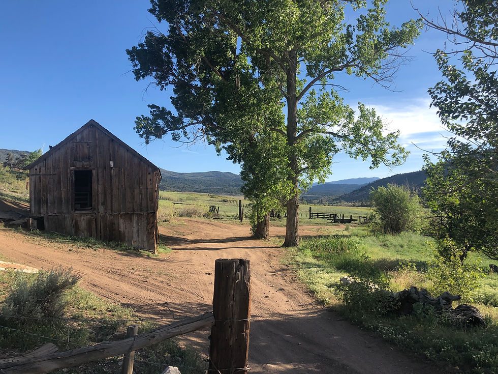
A peaceful place that time has forgotten. This was the only structure we saw on the 20+ mile route we traveled. The Carson River is a very short distance from this old barn.
By the way, we saw Tony Tacoma again when we stopped to air up our tires at a gas station just south of Gardnerville. He was doing the same! When I asked Tony how he knew he'd make the water crossing, he said, and I quote "I didn't."


Comments